Chappaquiddick Portrait
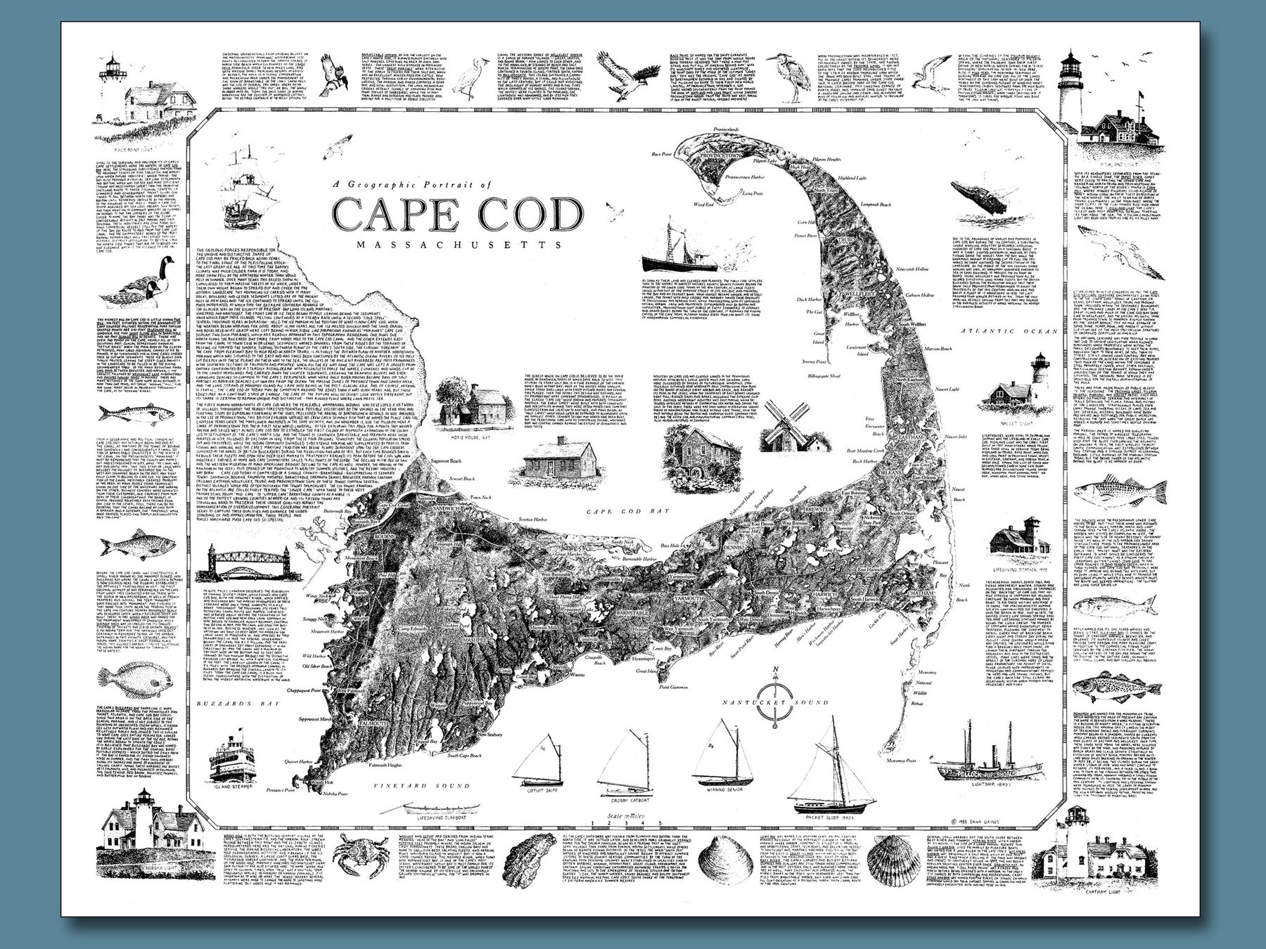
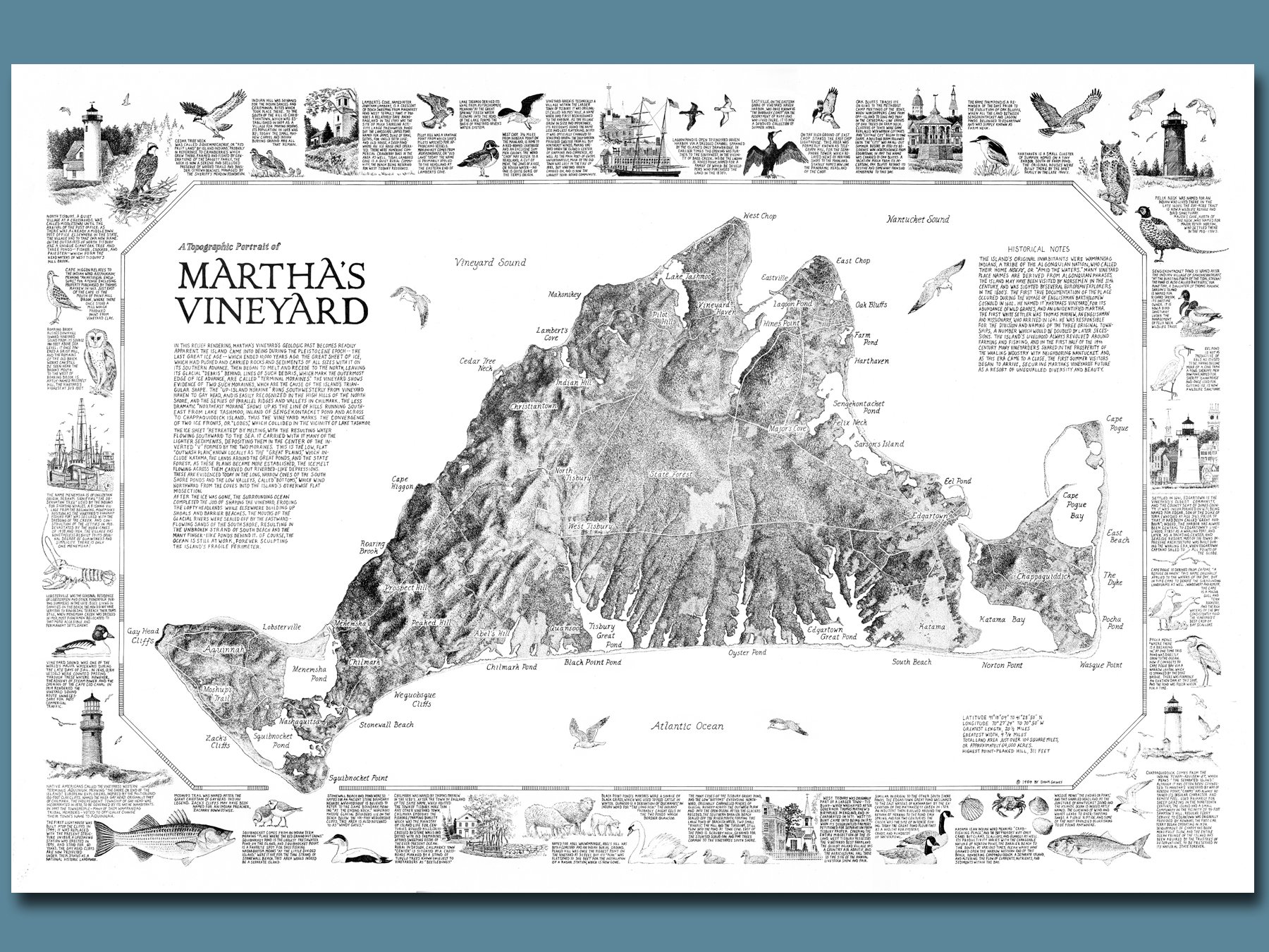
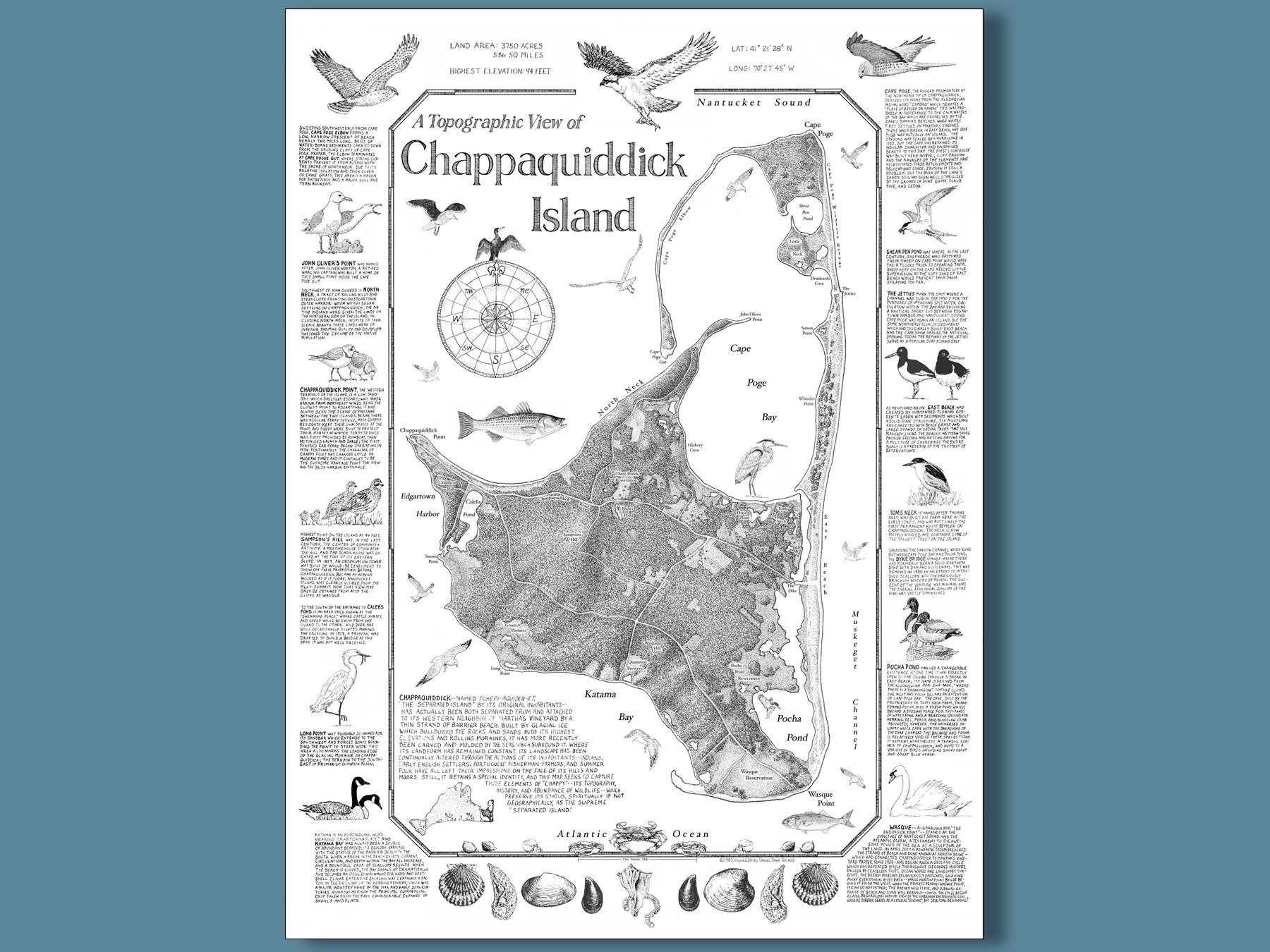
The first map I ever published, originally drawn in 1983 and re-released in 2011 with an updated topographical rendering. Created as a “test case” to see if the approach would be popular with a small but fiercely devoted customer base, it exceeded expectations and led to similar compositions of Martha’s Vineyard, Cape Cod and Nantucket. Utilizing USGS topo maps I developed a method for portraying light and shadow, leading to a three-dimensional effect; I was very “Chappy” with the result! 18” x 24” print on off-white paper, shipped rolled in cardboard tube and plastic sleeve.
The first map I ever published, originally drawn in 1983 and re-released in 2011 with an updated topographical rendering. Created as a “test case” to see if the approach would be popular with a small but fiercely devoted customer base, it exceeded expectations and led to similar compositions of Martha’s Vineyard, Cape Cod and Nantucket. Utilizing USGS topo maps I developed a method for portraying light and shadow, leading to a three-dimensional effect; I was very “Chappy” with the result! 18” x 24” print on off-white paper, shipped rolled in cardboard tube and plastic sleeve.
The first map I ever published, originally drawn in 1983 and re-released in 2011 with an updated topographical rendering. Created as a “test case” to see if the approach would be popular with a small but fiercely devoted customer base, it exceeded expectations and led to similar compositions of Martha’s Vineyard, Cape Cod and Nantucket. Utilizing USGS topo maps I developed a method for portraying light and shadow, leading to a three-dimensional effect; I was very “Chappy” with the result! 18” x 24” print on off-white paper, shipped rolled in cardboard tube and plastic sleeve.